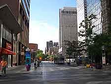
Denver International Airport (DEN)
Driving Directions / Travel by Car
(Denver, Colorado - CO, USA)

The Denver International Airport (DEN) is a vast complex and connected to the city by the Pena Boulevard, which leads to the I-70 interstate. Many prominent landmarks are passed along this route towards downtown Denver, such as Montbello Central Park, the Martin Luther King Park, the Park Hill Golf Club and Globeville Landing.
Useful points of reference near Denver Airport include the Rocky Mountain Arsenal National Refuge and Commerce City to the west, Barr Lake to the northwest, and the Buckley Air Force Base (AFB) to the south. Also nearby and just a short distance from central Denver is the Cherry Creek State Park to the south, near to Aurora, Greenwood Village and Centennial.
Directions to Denver International Airport (DEN) from Boulder:
- Travel along Highway US-36 in a southerly direction
- Take the I-25 interstate and head south
- Join the I-70 interstate and head east
- Follow the sign posts to the airport grounds
Directions to Denver International Airport (DEN) from the Rocky Mountains:
- Travel along the I-70 interstate in an easterly direction
- Follow the signs
Directions to Denver International Airport (DEN) from Denver Tech Center and Colorado Springs:
- Travel along the I-225 interstate in a northerly direction
- Take the I-70 interstate and head east
- Follow the signs
Directions to Denver International Airport (DEN) from Fort Collins:
- Travel along the I-25 interstate in a southerly direction
- Take 104th Avenue and head east
- Follow the signs
Directions to Denver International Airport (DEN) from the downtown district:
- Travel along the I-25 interstate in a northerly direction
- Take the I-70 interstate and head east
- Follow the signs
Denver International Airport (DEN): Virtual Google Maps
